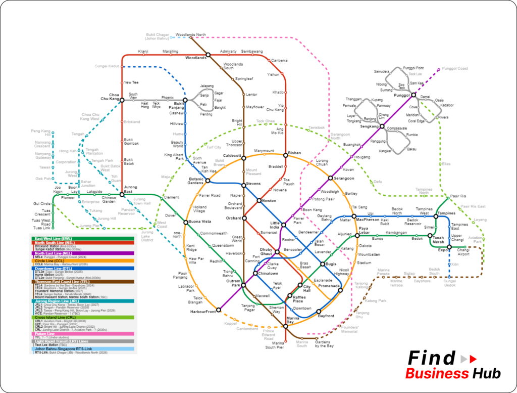
MRT Map Singapore
Download or View the Map for Easy Navigation

One of the world’s most dynamic cities, Singapore is easy to navigate thanks to its efficient and comprehensive mass rapid transit (MRT) system. Whether you’re a local commuter or a tourist visiting the city, access to a detailed MRT map is essential for a seamless journey. This guide will give you everything you need to know about the MRT map in Singapore, including how to download or view it, tips for using it, and why it’s a must-have for anyone in the city.
Understanding the MRT System in Singapore
The MRT system in Singapore is the backbone of the city’s public transportation network, connecting all corners of the island with a reliable, fast, and cost-effective service. The system is made up of several lines, each identified by different colors and names, including the North-South Line (Red), East-West Line (Green), Circle Line (Orange), Downtown Line (Blue), and more. These lines intersect at various points, allowing for easy transfers and comprehensive coverage of the city.
Benefits of Using the MRT Map
Ease of Navigation
The MRT map is designed in a user-friendly manner with clear indicators of each line, station and transfer point. By familiarizing yourself with the map, you can easily plan your trip and ensure you take the most efficient route to your destination.
Time and Cost Efficiency
Using the MRT map helps you save time by finding the fastest routes and avoiding unnecessary transfers. Additionally, it allows you to effectively budget your travel expenses by choosing the most direct routes.
Accessibility
The MRT system is highly accessible, with facilities and services for people with disabilities, parents with strollers and those traveling with heavy luggage. This map depicts the stations with such facilities which make it convenient for everyone to travel.
